The first thing I noticed when I arrived in the ghost town of Chesterfield, was that Chesterfield is spread out over a very open area—2,160 acres to be exact—when including the outlying areas. Most of the town consists of spacious grass fields and some farmland with deteriorating buildings scattered here and there. Chesterfield is not entirely abandoned as there are a few summertime residents. There is a museum in the old general store staffed by friendly volunteers who are more than willing to tell you stories about their little town. They also provide maps with the names of the residents that once lived in each of the houses that were still standing. When I first arrived I was greeting by one of the volunteers who chased me down in their ATV and offered to give me a guided tour of the place.
At one time, the Oregon Trail passed through the Portneuf Valley, close to where Chesterfield was later founded. Fur traders and trappers journeyed through the valley as early as 1811. Up until 1836, the Oregon Trail was passable only on horseback or by foot until it was improved enough to become a wagon trail. The Oregon Trail was most heavily used from 1846 to 1869, until the completion of the first transcontinental railroad which provided a much easier journey through the West.
By the time Chester Call and his niece’s husband, Christian Nelson, arrived from Bountiful, Utah, the trail had been little used for about 10 years although some wagon trains still came through. They were searching for a suitable location to keep their herd of 300 horses. The two men traveled extensively through southeastern Idaho and even into Wyoming without success. They eventually came across the old Oregon Trail and followed it through the Portneuf Valley.
A bronze plaque on a stone monument, erected in the middle of town by the Daughters of Utah Pioneers, reads as follows:
“After the arrival of the first settlers of Chesterfield in 1875, covered wagon trains continued to use the old Oregon Trail of 1846 which passed this point. Tired discouraged and ill, travelers arrived here from early spring to late autumn. Local pioneers fed the hungry, nursed the sick, replenished their supplies and exchanged fresh horses for the weak or lame ones.”
Unfortunately for the budding community, the valley was plagued by drought and severe winters from 1898 to 1900, and another harsh winter in 1908. “Harsh” is an understatement: temperatures dropped to 60 degrees below zero, snow reached depths of eight feet, and 1,600 sheep froze to death. Children got sick and many residents died. Even though the town is located on the valley floor, its elevation of over 5,400 feet guarantees a brutal winter. In the summer months the town had to deal with swarms of locusts and frequent lightning strikes which burned down buildings. Despite this, the community had grown to seventy-three families with 418 people, but many couldn’t endure the deadly winters and left, cutting the population in half by 1908.
All photos of Chesterfield were taken by me.
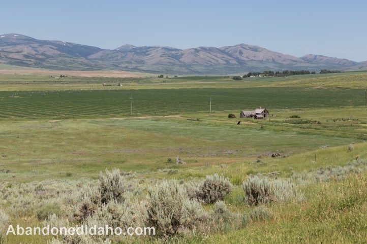
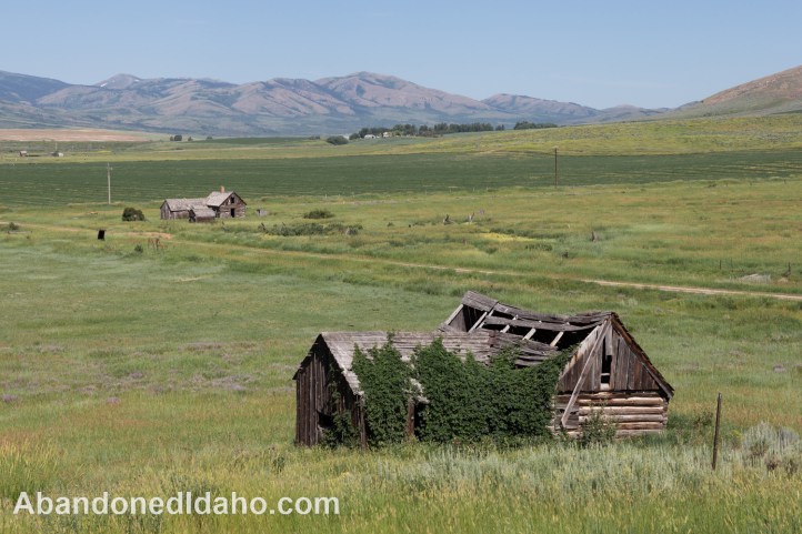
They finally found an area with widespread knee-deep natural grasses and a water source. They decided to settle there, and in 1875, they traveled back to Bountiful and invited a dozen Mormon families to come and join them. According to Chester Call’s great-granddaughter, Chester “was a man of great vision and energy, and he possessed great persuasive skills in dealing with both the settlers and the Indians.” The community was named Chesterfield in honor of Chester Call and because it reminded some of the settlers of their native town of Chesterfield, England. This was a good idea. The original name of the community was the unimaginative “24 Mile Rd” because it was 24 miles from Soda Springs, Idaho. The Edward Reese house is located on the west side of Chesterfield. Except for the farmland, dirt roads, and buildings, this is what Chester Call saw when he arrived here in 1875.
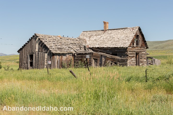
I drove down the hill to get a closer look at the Edward Reese house. It looks like it was built in two stages. First to be constructed was the log cabin on the right, and then an extension made with cut lumber was added on the left.
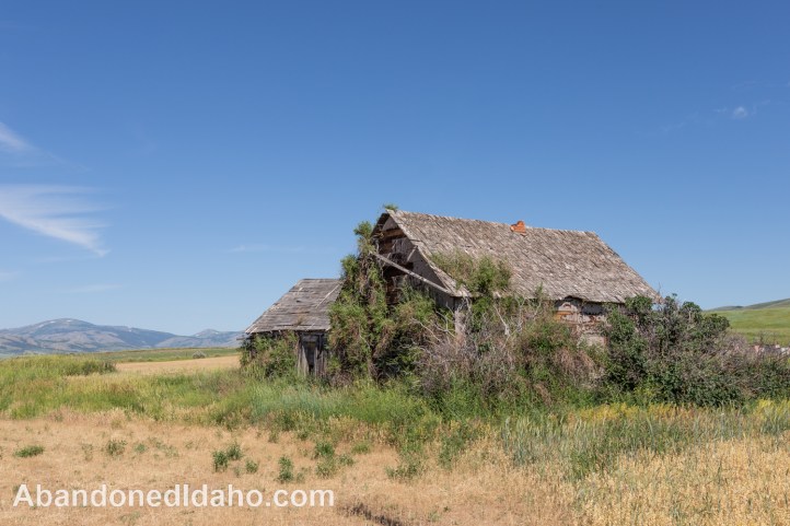
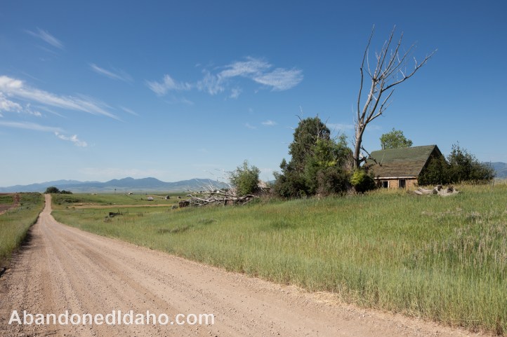
Amos Hatch house once lived here. It is located on Cabin Road, close to the center of Chesterfield. The house is pretty much being taken over by trees and bushes.
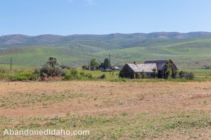
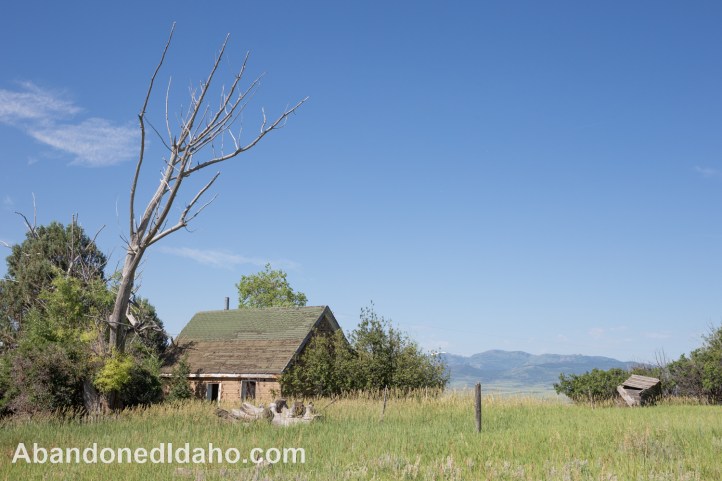
This is the back side of the Amos Hatch house. The Chesterfield Mountain Range is visible in the distance, just a few miles away.
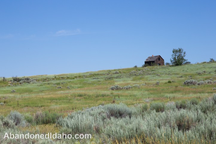
The James McClellan house is shown in the foreground, with the Edward Reese house in the distance. Volunteers are working to preserve some of the homes, but for many, such as this one, such efforts are too late.
The Emery Davids house is located on 24 Mile Rd. The road was given this name due to the fact that Chesterfield was 24 miles from the town of Soda Springs.
Part of the roof of the Emery Davids house was covered with brown asphalt shingles, and part of it with green asphalt shingles. For some reason, I have found during my exploration of abandoned houses, dead trees are often found next to the houses.
The Ed Thomas house was small, but it had an attic with a window. There was no road to this house that I could find, so this was the closest that I could get to it. One descendant of a pioneer explained that his grandfather put a floor in their attic big enough for two beds and had four children sleep in each bed.
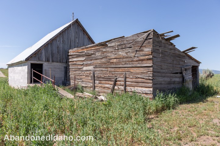
Directly behind the Martha Reese house stand two barns; one that is over 100 years old, and one built of cinder blocks much later. In Chesterfield, as with many pioneer towns of the West, the population fluctuated dramatically. There was a resurgence in the population, which by 1920 reached almost seven hundred. However, hardships during the Great Depression caused many families to depart, once again halving the population.
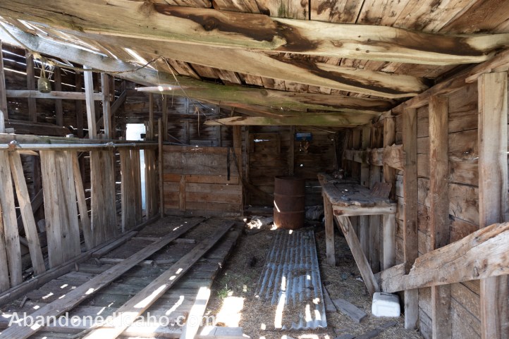
This is the sight looking through the doorway of the older barn.
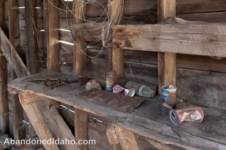
The rusted-out Idaho license plate was issued in 1935. The soft drink cans were left there much more recently. The design seen on the Coca-Cola® cans was used on their 1966 products.
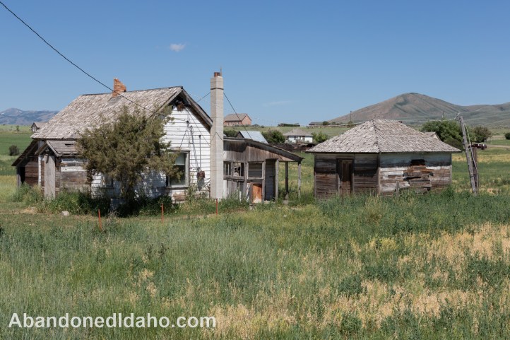
This was Ira Call’s house. Originally built as a log cabin, wood siding was added later. For a short time, it was the home of two polygamous families. By the 1940s, most of the buildings in town had been abandoned, including the only school. By 1970, the number of residents had dwindled to just twentey. A local non-profit, the Chesterfield Foundation, is currently working on restoring some of the town’s abandoned buildings.
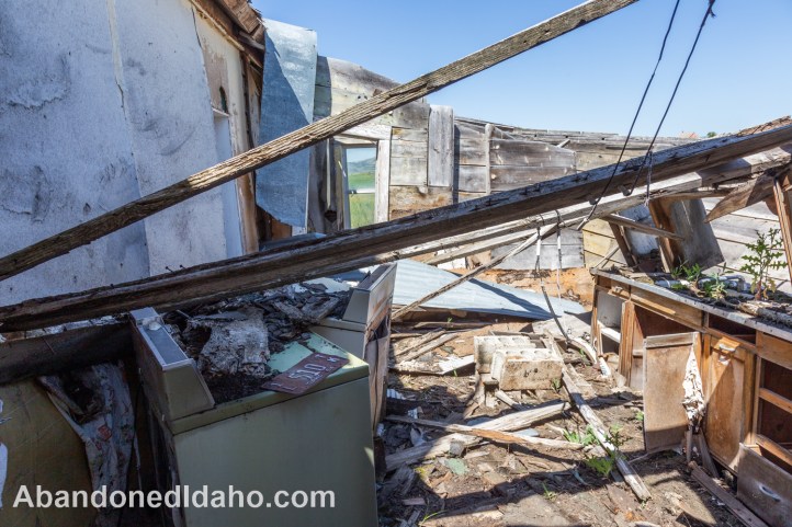
The is the back side of the house. It suffered from a fire years ago. Judging by the debris-filled sink on the right, this used to be the kitchen. Apparently someone owned a truck in 1954. Chesterfield had some inhabitants into the 1970s.
You can leave a comment by scrolling down to the very bottom of this post to where you see “Leave a comment“. Please subscribe to our blog if you would like to be notified of new posts and/or new comments.

